Tag: Conservation & Wildlife

  • Climate change may shift suitable ranges of four Taxus species northward

    Climate change may shift suitable ranges of four Taxus species northward

    What the study found

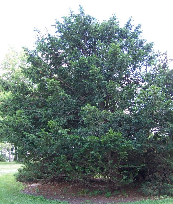
    The study found that the four Taxus species examined have different current suitable habitats in China, and that future climate scenarios may change those habitats in different ways. The authors report that the distribution centers are predicted to move toward higher latitudes over time.

    Why the authors say this matters

    The authors say this is important for conserving wild Taxus resources, supporting artificial propagation, and guiding sustainable development. They conclude that the results provide a reference for conservation strategies and introduction and cultivation initiatives.

    What the researchers tested

    The researchers used the MaxEnt model, a species distribution modeling approach, to estimate where four Taxus species could grow under current climate conditions and under four future shared socioeconomic pathways (SSP126, SSP245, SSP370, and SSP585). They examined three future time periods: the 2050s, 2070s, and 2090s, and assessed environmental factors linked to distribution.

    What worked and what didn't

    The models performed well, with area under the curve values above 0.9. The coldest monthly minimum temperature was the main environmental factor affecting distribution for most species, while human footprint was the main factor for Taxus cuspidata. Suitable area was predicted to expand for Taxus wallichiana and Taxus wallichiana var. chinensis, but to both expand and contract for Taxus wallichiana var. mairei and Taxus cuspidata.

    What to keep in mind

    The summary provided does not describe experimental field validation beyond the modeling approach. The abstract also does not give detailed uncertainty estimates for the future projections or explain how strongly each future scenario differed from the others.

    • Four Taxus species in China were modeled under current and future climate scenarios.
    • The coldest monthly minimum temperature was the main driver for most species.
    • Taxus cuspidata was most influenced by human footprint rather than temperature.
    • Suitable habitat was predicted to expand for Taxus wallichiana and Taxus wallichiana var. chinensis.
    • Distribution centroids were predicted to shift toward higher latitudes over time.
  • Dingo-exposed wombats investigated scent cues more often

    Dingo-exposed wombats investigated scent cues more often

    What the study found

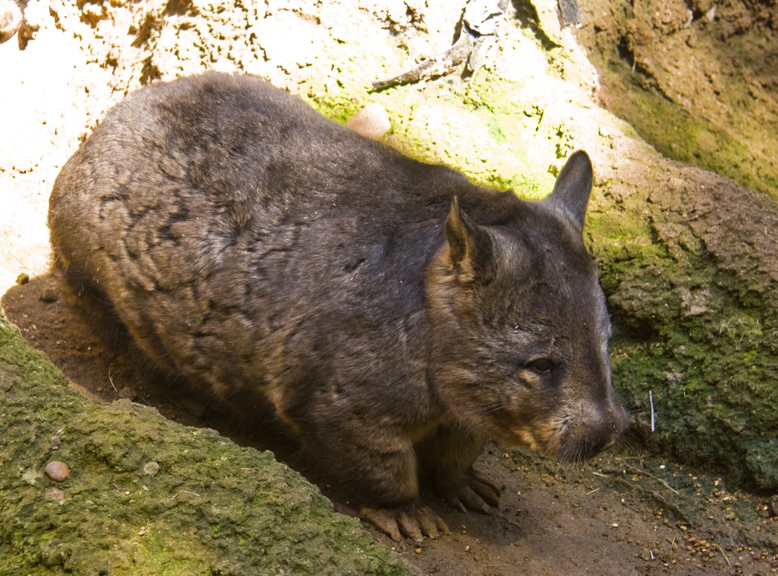
    Southern hairy-nosed wombats showed similar overall response patterns in both study locations, but wombats from dingo-exposed areas were significantly more likely to investigate scent cues in general. Both groups were more likely to investigate dingo scent than rabbit scent.

    Why the authors say this matters

    The authors conclude that investigating novel scent cues is the first step in assessing whether a threat is present and whether a behavioral response is needed. The study suggests this provides foundational insight into experience-based predator responses in southern hairy-nosed wombats and helps improve understanding of prey naivety.

    What the researchers tested

    The researchers studied southern hairy-nosed wombats in areas that had been exposed to dingoes for over 80 years and in areas where dingoes were absent. Camera traps were placed at wombat burrows and paired with one of three olfactory treatments: dingo faeces, rabbit faeces, or no scent, and wombat behaviors were recorded and analyzed with statistical models.

    What worked and what didn't

    Dingo scent was investigated more often than rabbit scent in both locations. Dingo-exposed wombats were significantly more likely to investigate scent overall than dingo-absent wombats, but the abstract does not report a direct anti-predator behavioral response beyond scent investigation.

    What to keep in mind

    The abstract does not describe detailed limitations, sample sizes, or how strongly the findings can be generalized beyond the study locations. The reported behavior is investigation of scent cues, not a direct measure of escape or defensive response.

    • Southern hairy-nosed wombats in both locations investigated dingo scent more than rabbit scent.
    • Wombats from dingo-exposed areas were more likely to investigate scent overall than those from dingo-absent areas.
    • The study used camera traps at burrows and three scent treatments: dingo faeces, rabbit faeces, and no scent.
    • The authors describe scent investigation as an initial step in assessing potential threat.
    • The abstract presents foundational insight into experience-based predator responses in this species.
  • Humidity strongly shaped fire intensity in the Cerrado

    What the study found

    The study found that relative air humidity at the time of burning was a key predictor of fire behaviour in the Cerrado, a tropical humid savanna. Early dry season fires could be as intense as late dry season fires when daytime humidity was lower, while higher evening humidity was linked to lower-intensity early dry season fires.

    Why the authors say this matters

    The authors conclude that fire management in Cerrado landscapes should take advantage of different diurnal, seasonal, and fuel-load conditions to meet specific management objectives. The study suggests that recognizing local conditions may improve management cost benefits.

    What the researchers tested

    The researchers carried out experimental fires in early and late dry seasons. They compared fires set during day and evening and in areas with different fuel loads, and they assessed effects on fire intensity and fuel consumption.

    What worked and what didn't

    Early dry season fires under lower daytime relative humidity showed fire intensities similar to late dry season fires. Under higher evening relative humidity, early dry season fires were less intense, and this varied with the amount of available fuel in different years. The abstract does not report detailed fuel-consumption results.

    What to keep in mind

    The summary does not provide details on the size of the experimental fires, the exact measurements used, or the statistical results. It also does not describe limitations beyond noting that the findings vary with local conditions and fuel availability.

    • Relative air humidity at burning time was identified as a key predictor of fire behaviour.
    • Early dry season fires could reach similar intensities to late dry season fires under lower daytime humidity.
    • Higher evening humidity was linked to lower fire intensity in early dry season burns.
    • Fire intensity also varied with available fuel in different years.
    • The authors recommend using seasonal, daily, and fuel-load differences in fire management decisions.
  • Climate warming and urban context shape European butterfly declines

    Climate warming and urban context shape European butterfly declines

    What the study found

    The study found that climate warming and aridification were consistently linked to butterfly population declines in both urban and rural settings. The authors also report that urban context can strengthen the negative effects of climate change on these populations.

    Why the authors say this matters

    The authors conclude that butterfly population change is shaped by a complex interplay of climate change, urban context, and species traits. They suggest that urbanisation generally amplifies the negative impact of climate change on insect population trends.

    What the researchers tested

    The researchers analysed long-term monitoring data from more than 8,400 populations of 145 butterfly species across 869 sites in 12 European countries. They modelled population trends against temperature, precipitation, aridity, urbanisation, urban versus rural context, and species traits including trophic specialisation, body size, reproductive rate, and thermal adaptation.

    What worked and what didn't

    Climate warming and aridification were consistently associated with declines in butterfly populations in both rural and urban contexts. Urbanisation by itself did not predict trends, but the urban-rural context strongly changed how species responded to warming; species with colder thermal niches and lower reproductive rates were most vulnerable. Under aridification, trophic specialists declined more in urban areas, while generalists declined more in rural sites.

    What to keep in mind

    The abstract does not describe specific limitations of the study. It also notes that precipitation effects varied by location and species, so those results were not consistent across the full data set.

    • Climate warming and aridification were linked to butterfly population declines across Europe.
    • Urbanisation alone did not predict butterfly population trends.
    • Urban context strengthened the negative impact of warming on butterfly populations.
    • Species with colder thermal niches and lower reproductive rates were most vulnerable to warming.
    • Precipitation effects varied by location and species.
    • Under aridification, trophic specialists declined more in urban areas, while generalists declined more in rural sites.
  • Human activity, snow cover, and precipitation shape Altai mammal and bird ranges

    What the study found

    The study found that most of the 27 animal species analyzed are predicted to occur mainly in the northwest of the Altai Mountains under current conditions. It also found that, in future scenarios, habitats in the central region may be largely lost and many species may shift toward higher altitudes or latitudes.

    Why the authors say this matters

    The authors say the findings matter because ongoing global climate change and human activities are altering potentially suitable habitats in the Altai Mountains. They conclude that a transboundary protected area across China, Kazakhstan, Mongolia, and Russia, along with reduced human impacts on wildlife and habitats, is warranted.

    What the researchers tested

    The researchers evaluated and predicted the distribution dynamics of 27 animal species and the resulting changes in species richness in the Altai Mountains. They used the MaxEnt model, a species distribution modeling approach, for current and future periods and examined human activity, snow cover, and precipitation of the coldest quarter as predictors.

    What worked and what didn't

    Human activities, snow cover, and precipitation of the coldest quarter were identified as the most important predictors for the potential distributions of most species. Most species were predicted to be concentrated in the northwest under current conditions, while central habitats were projected to be lost in the future. The study also reports a tendency for range shifts toward higher altitudes or latitudes.

    What to keep in mind

    The abstract does not describe detailed limitations, uncertainty ranges, or model performance measures. The summary is limited to the 27 species studied in the Altai Mountains and to the current and future periods analyzed with the MaxEnt model.

    • Most of the 27 species are predicted to be mainly distributed in the northwest of the Altai Mountains now.
    • Future habitats in the central Altai Mountains may be largely lost.
    • Many species are expected to shift toward higher altitudes or latitudes.
    • Human activity, snow cover, and coldest-quarter precipitation were the strongest predictors reported.
    • The authors recommend a transboundary protected area across China, Kazakhstan, Mongolia, and Russia.
  • Hierarchical eco-zonation identified five ecoregions in Uganda

    What the study found

    The study found that a hierarchical eco-zonation framework could delineate five ecoregions in Uganda and subdivide them into three finer bioregion levels. The coarsest levels showed stronger ecological coherence than the finer levels.

    Why the authors say this matters

    The authors conclude that the framework offers a flexible, open-data and open-software approach for ecological stratification and biogeographical analysis in data-scarce Afrotropical landscapes. They say it supports biodiversity assessment, conservation planning, and ecological management applications.

    What the researchers tested

    The researchers tested a machine-learning workflow that combined multiple algorithms with open-source software and globally accessible datasets. Using Uganda as a case study, they modeled eco-zonation with climate, topography, and hydrological variables, then compared the results with potential natural vegetation using spatially dispersed 10-fold cross-validation.

    What worked and what didn't

    Predictive accuracy declined from 80.35% at the ecoregion level to 52.69% at bioregion level III. The two coarsest tiers, ecoregions and bioregion I, showed strong ecological coherence, while bioregion II and bioregion III showed weak coherence.

    What to keep in mind

    The finer tiers lacked empirical ecological validation and were described as experimental abiotic subdivisions meant to capture theoretical fine-scale heterogeneity. The abstract says that the limited thematic resolution of available biota datasets is a key constraint for robust finer-scale ecological stratification.

    • Five ecoregions were delineated for Uganda.
    • Those ecoregions were subdivided into three bioregion levels.
    • Ecological coherence was stronger at the two coarsest tiers than at finer tiers.
    • Predictive accuracy fell from 80.35% to 52.69% across the hierarchy.
    • The authors link weaker fine-scale results to limited thematic resolution in available datasets.
  • Epicormic foliage chemistry varied after fire

    Epicormic foliage chemistry varied after fire

    What the study found

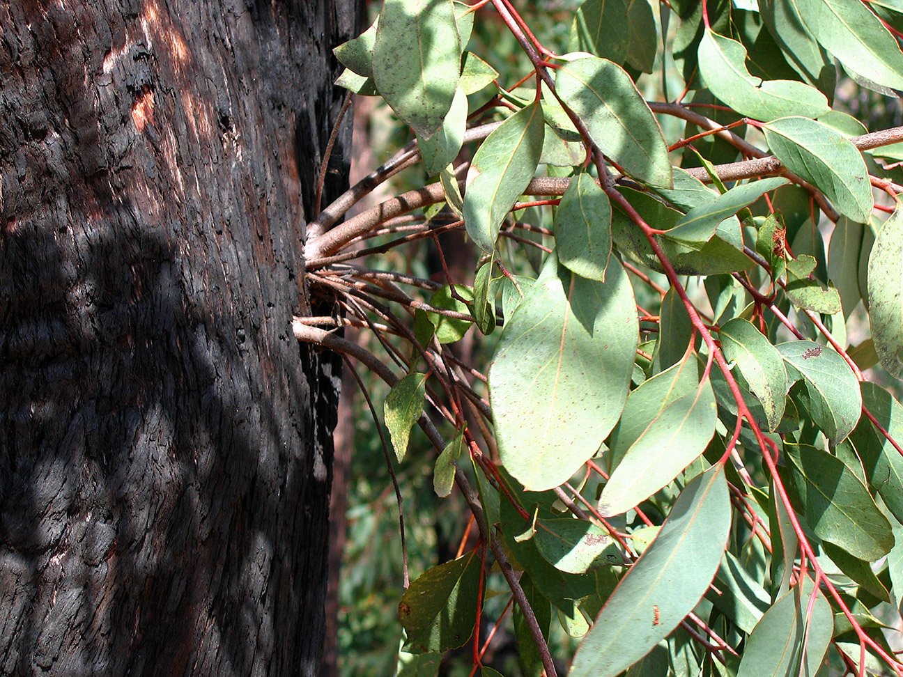
    Epicormic regrowth, the new shoots that sprout from living tree tissue after fire, differed chemically from mature foliage. The pattern depended on species and subgenus, and the suitability of this regrowth for leaf-eating animals was highly context-dependent.

    Why the authors say this matters

    The authors suggest that post-fire food availability for arboreal folivores, such as koalas and southern greater gliders, depends not just on whether foliage returns quickly, but on its chemistry. They conclude that forests with a mix of resprouting eucalypt species may provide enough nutrition to support these animals during recovery.

    What the researchers tested

    The researchers sampled Eucalyptus foliage in mixed-species eucalypt forests dominated by monocalypt and symphyomyrtle subgenera in southeastern Australia. They compared leaves collected a year before and after the 2019/20 Black Summer bushfires to see how epicormic leaf chemistry differed from mature leaves and whether the regrowth seemed nutritionally suitable for arboreal folivores.

    What worked and what didn't

    Epicormic leaves generally had higher nitrogen concentrations than mature leaves, but not necessarily higher available nitrogen. Subgenus-specific plant secondary metabolite (PSM, herbivore-deterring chemical) concentrations were higher in epicormic foliage of symphyomyrtle species, while monocalypt species showed lower PSMs after fire.

    What to keep in mind

    The abstract does not report detailed limitations or uncertainty measures. The findings are based on the sampled forests and species mix in southeastern Australia, so the results are described as context-dependent rather than universal.

    • Epicormic regrowth differed chemically from mature eucalypt foliage.
    • Differences in epicormic leaf chemistry were driven by species and subgenus.
    • Epicormic leaves generally had higher nitrogen, but not always higher available nitrogen.
    • Symphyomyrtle species had higher PSM concentrations in epicormic foliage after fire.
    • Monocalypt species showed lower PSMs in post-fire epicormic foliage.
    • The authors suggest mixed-species forests may better support arboreal folivores during recovery.
  • Prioritized road segments for wildlife crossing structures were identified

    Prioritized road segments for wildlife crossing structures were identified

    What the study found

    The study found that a multi-species framework could identify and rank road segments for wildlife crossing structures across a national road network. It identified 167 high-priority locations in Israel and found that the existing wildlife overpasses there did not match those locations.

    Why the authors say this matters

    The authors conclude that wildlife crossing structures are costly, so placing them at the most effective sites is important. They suggest this methodology may improve decisions about road mitigation by combining expert-based inferences with data-based insights.

    What the researchers tested

    The researchers developed a national-scale, multi-species prioritization method and demonstrated it for 20 focal species in Israel across 6,992 km of roads. They modeled habitat suitability, mapped core habitats, calculated resistance surfaces, identified movement corridors with a least-cost method, and ranked 100 m road segments using corridor priority, movement cost, and road orientation.

    What worked and what didn't

    The corridor mapping and prioritization approach identified suitable road segments for wildlife crossing structures. A sensitivity analysis found the method was robust to most parameters, except for minimal core width, and 68.2% of the potential crossing locations overlapped with corridors mapped from expert opinion. However, all existing wildlife overpasses in Israel were reported as not aligning with the high-priority locations.

    What to keep in mind

    The abstract describes a national-scale demonstration in Israel, so the scope is limited to that setting and the 20 focal species used. It also notes that the method is robust to most parameters except minimal core width, but does not provide further limitations in the available summary.

    • A multi-species method was developed to rank wildlife crossing structure locations at a national scale.
    • The demonstration covered 20 focal species and 6,992 km of roads in Israel.
    • The study identified 167 high-priority wildlife crossing structure locations.
    • Existing wildlife overpasses in Israel did not align with the high-priority locations identified.
    • Most parameters in the sensitivity analysis did not strongly affect the method, except minimal core width.
  • Carbon neutrality emissions cuts affect wildfire risk differently across China

    What the study found

    The study found that wildfire risk under carbon neutrality differs by region in China because different climate factors dominate in different places. Reductions in aerosols, tiny particles in the air that can affect climate, can increase wildfire risk, while reductions in greenhouse gases can reduce it.

    Why the authors say this matters

    The authors conclude that understanding how emissions reductions affect regional climate responses is important for managing wildfire risk while pursuing carbon neutrality. The findings indicate that wildfire adaptation needs to account for opposing effects from aerosol and greenhouse gas reductions.

    What the researchers tested

    The researchers used the coupled Community Earth System Model, or CESM1, to examine how future reductions in aerosol and greenhouse gas emissions affect wildfire risk in major fire-prone regions of China. They compared regional climate responses under carbon neutrality scenarios.

    What worked and what didn't

    Aerosol reductions were associated with amplified wildfire risk, especially in southern China, because they weakened atmospheric cooling and increased dryness. Greenhouse gas reductions lowered wildfire risk by reducing temperature and increasing precipitation, and this risk reduction outweighed the aerosol-driven increase overall, although the balance varied substantially by region.

    What to keep in mind

    The abstract does not describe specific model limitations, uncertainty ranges, or observations used for direct validation. The results are presented for major fire-prone regions in China under future carbon neutrality scenarios.

    • Wildfire risk under carbon neutrality varies by region in China.
    • Aerosol reductions can increase wildfire risk, especially in southern China.
    • Greenhouse gas reductions can lower wildfire risk by reducing temperature and increasing precipitation.
    • The greenhouse gas-driven decrease in risk outweighs the aerosol-driven increase overall.
    • Northern and southern China show different dominant wildfire drivers in future scenarios.
  • Dog team detected carcasses more often than human surveyors

    What the study found

    The study found that a conservation detection dog detected avian carcasses more often than human surveyors. Detection also varied with carcass size and ground substrate, with larger carcasses and areas with lower vegetative complexity being easier to detect.

    Why the authors say this matters

    The authors say the findings can help managers design carcass surveys under different tradeoffs and scenarios. They conclude that better detection can improve wildlife mortality monitoring and support more accurate mortality estimates for management and conservation.

    What the researchers tested

    The researchers ran two years of detection trials in the semi-arid high desert of southern New Mexico, USA. They compared 27 human surveyors and one conservation detection dog across 1,096 trials using 238 carcasses from 50 avian species.

    What worked and what didn't

    The conservation detection dog had a significantly higher mean detection probability (0.87) than human surveyors (mean 0.49), whose individual means ranged from 0.25 to 0.71. For both surveyor types, detection probability was higher for larger carcasses and in areas with lower vegetative complexity.

    What to keep in mind

    The abstract does not describe detailed study limitations beyond the specific setting and trial design. The results come from one region, one dog team, and the survey conditions described in the study.

    • A conservation detection dog detected avian carcasses more often than human surveyors.
    • Human surveyor detection rates varied across individuals.
    • Larger carcasses were easier to detect than smaller carcasses.
    • Detection was higher in areas with lower vegetative complexity.
    • The study used 1,096 trials and 238 carcasses from 50 bird species.